Natural Response
On a normal winter day, at high tide, the water in the channels that wend from the Pacific Ocean through the Carpinteria Salt Marsh Reserve is about four to six feet deep. But after the massive Thomas Fire and subsequent mudslide, there have been few “normal” days this season at the site managed by UC Santa Barbara.
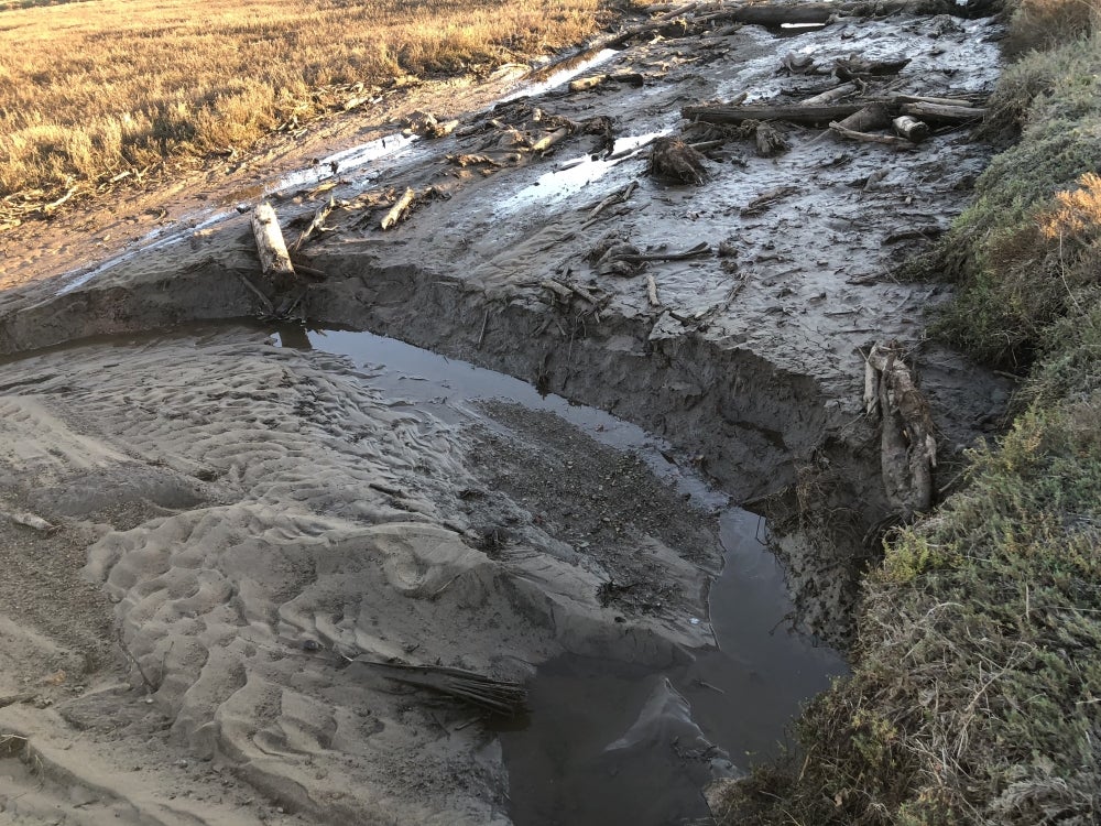
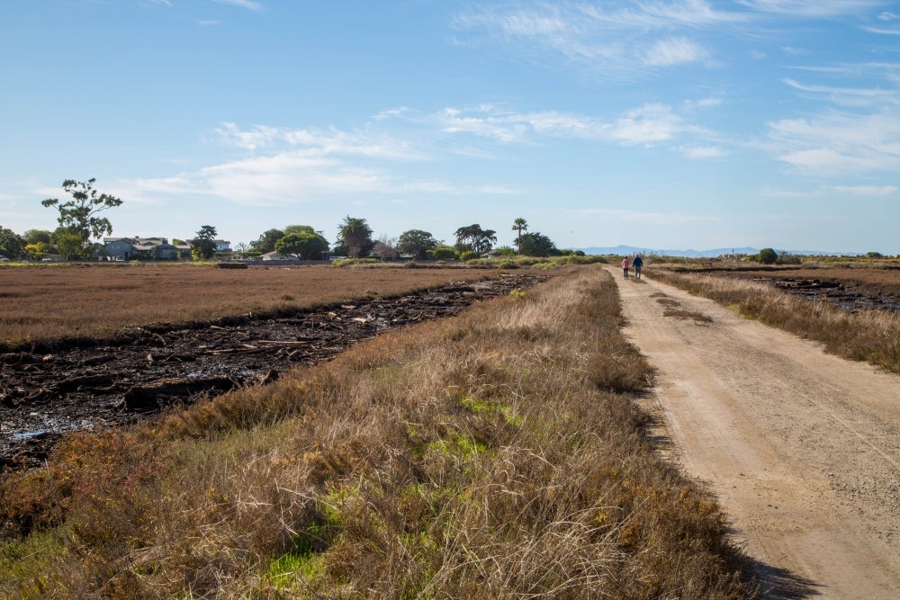
In several spots those channels today are instead filled with six feet of mud, logs and other debris — a roughly estimated 15,000-plus cubic yards of it all told — that washed into the reserve during the mudslide. The marsh sits below the Santa Ynez Mountains at the base of both the Franklin Creek and Santa Monica Creek watersheds.
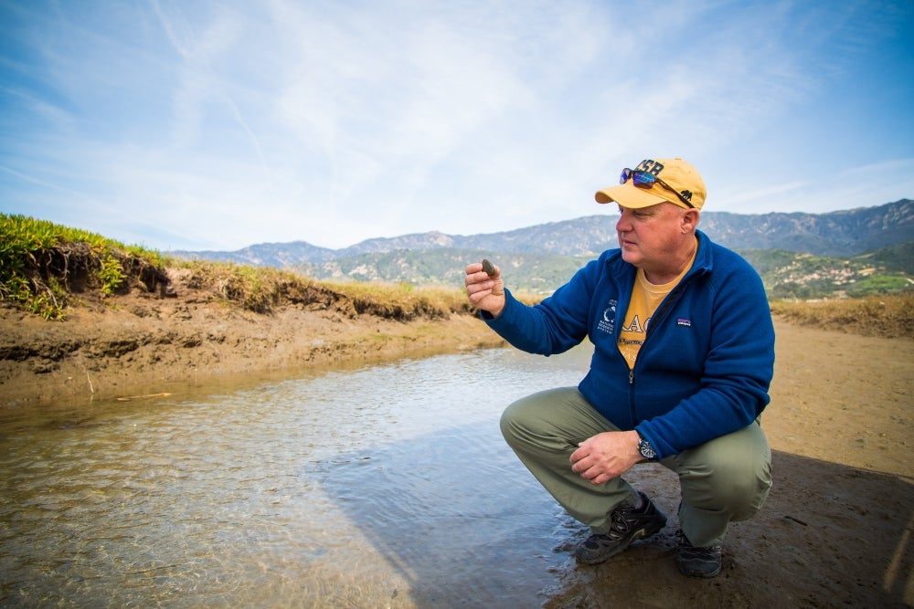
“When the storm hit it tore through the burn area, and there was nothing to prevent the water from washing all the soil away straight into the two creeks,” explained Andrew Brooks, a project scientist with UCSB’s Marine Science Institute and, since 2001, the reserve’s director. “It was probably headed out to the ocean, then it met an incoming tide, and that tide pushed all that material back into the marsh.”
Unrecognizable
When Brooks arrived at the marsh a few days after the January mudslide, he didn’t know what he’d find. Walking through the gate, things at first appeared as they usually do, he said. And then he walked farther into the reserve, which ends at the beach.
“The closer I got to the end of the road, it looked a little worse, and a little worse, and then I didn’t even recognize it,” Brooks said. “One channel was gone, essentially, completely filled mud and logs and other debris. My initial reaction was shock — this is something I certainly have never seen. A lot of different things start running through my head: How are we going to fix this? Should we fix it? If we should, how? And what is the overall impact to the marsh?”
The questions became their own answers and gave Brooks direction: research. What has damaged the marsh as he’s long known it is now providing rare opportunities to study how nature responds itself.
A powerful opportunity
In recent days, consecutive king tides of nearly 7 feet have thickened the plot. They dispersed some of the smaller debris from the channels toward the beach, and washed silt and sediment out to sea. But those “kings” also began to form new channels within those that are blocked, as the water entering and exiting with the tides begins to flow around or, in some cases, even through the debris dams. Over time, Brooks said, that should help to carry away some of the finer sediments clogging up those channels.
“What will happen to the remaining material — mostly large logs and stumps as well as some big branches — no one knows,” said Brooks. “It may sit there or be washed away. From a science perspective, that is one of the interesting things about this. We can all make guesses about what we think might happen, but because we haven’t observed an event like this in the past, we just can’t be sure. The goal now is to collect as much information as possible to help us make better and more accurate predictions in the future. The benefit of having this event occur on a UC reserve is that we are perfectly positioned to maximize that process.
“This marsh entered the UC Natural Reserve System in 1977, and during all that time, there have been hundreds of research studies conducted here,” Brooks continued. “We have a really good idea what the conditions were like before all this happened, so we can compare that to what we have now and how it changes moving forward. That’s a really powerful opportunity to learn something about how systems like these coastal wetlands respond to these events.”
Valuable information
Now Brooks, who was studying the reserve long before he began overseeing it, is putting out the call to researchers far and wide to embrace that opportunity. Investigators of bird feeding patterns and distribution, of marsh plant ecology, or of the organisms that make their home in the bottom of the channels — all will find an abundance of scientific questions to pursue.
And that’s not the half of it.
The food web alone will provide research fodder for years as the decimation of the food base in the sediment — crustaceans, arthropods, isopods — plays out across the entire marsh. It’s possible the elevation of the marsh surface has changed; what impact will that have? And really, what happens to an estuarine channel when it is completely filled with logs?
“These wetlands are periodically hit with weather events, and the system does get these large perturbations from runoff or from the inlet closing,” said UCSB biologist Mark Page, who has been conducting research in the reserve for decades. “This was a particularly big one because of the fire in combination with the rain. I’ve never seen in the entire time I’ve worked there all this woody debris stuck in the channels.”
Among Page’s vast work at the marsh is a long-term, ongoing project that monitors birds, vertebrates, fish and vegetation as a metric for comparison to the San Dieguito Wetland restoration to mitigate impacts from the San Onofre nuclear power plant. For about a decade, Carpinteria Salt Marsh Reserve has served as a reference site for that restoration.
“We were wondering how will this might affect our ability to use Carpinteria as a reference site, but I suspect it will come back,” Page said. “We’re doing so much sampling there that if we want to look at the resilience of the ecosystem to major perturbations, we are well-positioned to pick that up in what we’re already doing. We do aerial overflights and comprehensive sampling of fauna and flora — that may offer valuable information to look at recovery and how resilient the ecosystem is.”
A study in recovery
Given the estimated age of the marsh — between 8,000 and 10,000 years old, — it’s possible, noted Brooks, that this extreme one-two punch of a weather event has occurred before. If so, the marsh was able to recover.
“Over that 10,000-year geological history, the marsh undoubtedly has seen storms as intense as those experienced this January,” Brooks said. “It’s not unthinkable to consider that this particular event may have happened before. And if it has, we know the marsh was here a month ago, so obviously it recovered from those earlier events. The million-dollar question becomes did the system return to what was there before or did it change in some fundamental way and become something new? This current event may provide us with the ability to answer that question. Now we can study how the marsh recovers from the current impacts and identify the processes that are most important in that recovery. What we learn here may help other people in other areas that don’t have all this wealth of historical information.”
“Are there people in Louisiana who went through Katrina, or in Houston and the hurricane there, that have wetland systems like this but not all the historical data?” he continued. “This is a chance for them to come and do some research that could address situations or problems they’re facing back in their areas. The whole purpose of the UC Natural Reserve System is to be an outdoor lab for teaching and research, so we really want researchers to know there’s an opportunity here to come, do research and help expand upon our knowledge of how natural systems recover from these extreme events.”
Share this article


