The Perfect STORM

The Colorado River tumbles through varied landscapes, draining watersheds from seven western states. This 1,450-mile-long system is a critical water supply for agriculture, industry and municipalities from Denver to Tijuana.
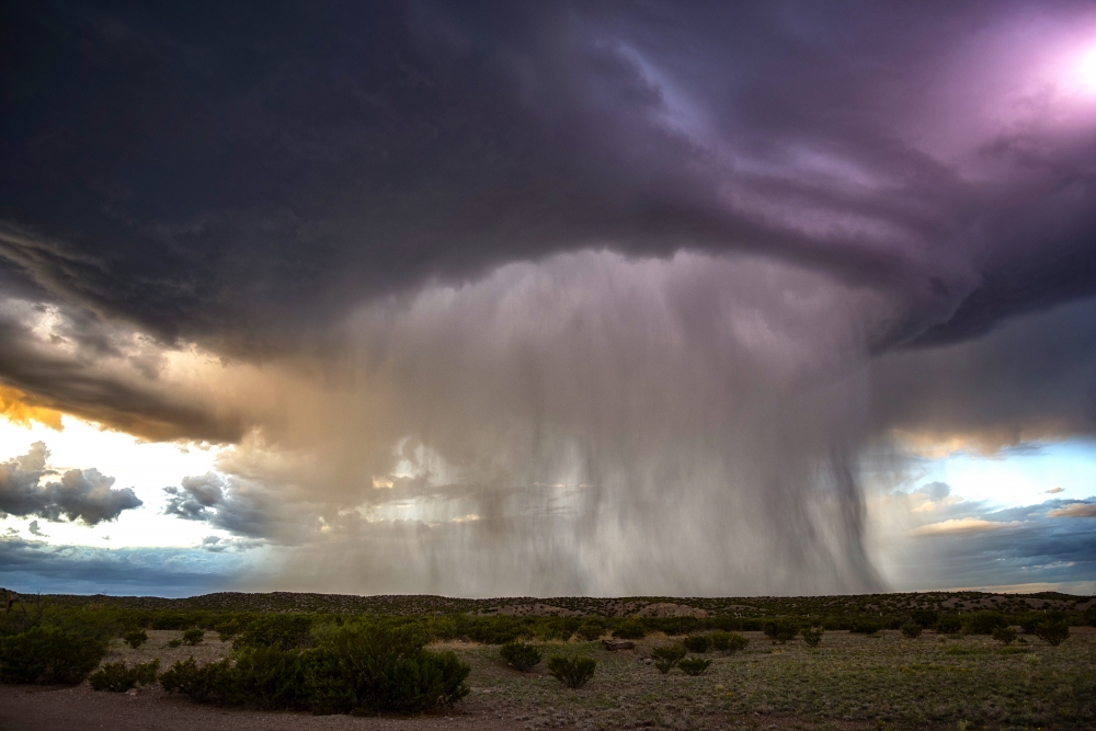
In the drylands of the Colorado’s lower basin, formed by Nevada, Arizona and California, thunderstorms — known in meteorological parlance as convective precipitation — typically control runoff, stream flow, water supply and flood risk to human populations in addition to water availability to vegetation.
Convective precipitation, which can lead to huge floods and subsequent disasters, is generated by heat from the Earth’s surface. Moisture quickly rises into the atmosphere and then condenses very rapidly to form sudden rainstorms that are poorly understood within global climate models and data sets.
Scientists use such information to explore how future climate change will impact rainfall, but to date they mostly have struck out when it comes to convective precipitation. Better understanding of this type of rainfall could help scientists improve statistical assessment and prediction of climate change through modeling.
To that end, hydrologists from UC Santa Barbara’s Earth Research Institute have developed a simple rainstorm generator (STORM). Their model simulates watershed rainfall under various climate change scenarios that reflect differences in the degree of wetness or storminess. The team’s findings, which appear in the journal Environmental Research Letters, provide insight into observed or projected regional hydrologic trends.
“We’re tackling a general problem that has regional implications, particularly in water-scarce areas,” said Michael Singer, also a lecturer at Cardiff University in Wales. “The general problem is, we know that climate change is occurring all over the globe, but what we don’t know is how it will affect convective precipitation and associated runoff.”
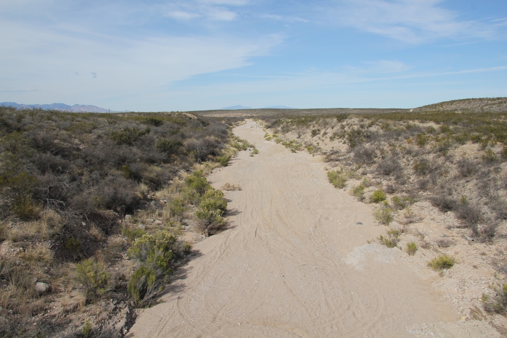
Singer and his co-author, Katerina Michaelides, addressed the problem by creating a model that enables researchers to investigate different types of climate change. They applied it to the area around the Walnut Gulch Experimental Watershed in Arizona, a place with excellent long-term historical rainfall data recorded on a per-minute basis.
“For a while, there’s been this mystery of a declining runoff signal in the lower Colorado River basin, in particular in the San Pedro River downstream of Walnut Gulch, which is very important regionally within southeast Arizona,” Singer explained. “In this part of the basin, people had long suspected that there was less runoff coming into these streams from ephemeral tributaries — ephemeral meaning they’re flowing sometimes but are dry most of the time.”
Combining the STORM model with analysis of the rainfall data set allowed the investigators to gain insights into decadal trends in monsoonal rainfall intensity under climate change. They found that there has been an increase in rainfall but less water delivered in heavy storms. This goes against previous notions of how rainfall should respond to atmospheric warming. The researchers attributed the phenomenon to less moisture being imported into the region from the Gulf of California or the Pacific Ocean during the monsoons.
“Even though it’s raining more overall, each storm is less intense and drops less water,” Singer said. “While the amount of rainfall is increasing through time and the smaller storms are dumping more rainfall overall, it comes in smaller and more frequent spurts. This lower-intensity rainfall implies less runoff over the surface, which means we should see a decline in runoff over a whole basin. And our model results agree well with runoff data: There has been a decline in runoff within this ephemeral stream.”
Still, this change in ephemeral runoff was too small to affect downstream flow by itself. Singer suggested a regional decline in snowpacks and less groundwater recharge at the mountain fronts has negatively affected water resources.
“You could say that the whole Colorado River basin has been affected in many ways by climate change,” explained Michaelides, also a senior lecturer at the University of Bristol in the United Kingdom. “Other research has shown declines in runoff for the upper Colorado basin, so our results lend support for a broader regional decline in water resources, which is probably what we’ll see in many places across the world.”
Even though STORM was developed using data from a rain gauge network in a single dryland drainage basin, it is applicable anywhere. STORM enables scientists to examine, over multiple decades, the details of where rainfall occurs and how much fell on a per-minute basis. To date, Singer and Michaelides have used it to identify real climate change over a broad region, but they are in the process of coupling STORM to a runoff model to explore scenarios of climate change and how they might really affect the magnitude and the frequency of runoff.
Share this article
Related Stories


