Expert Response
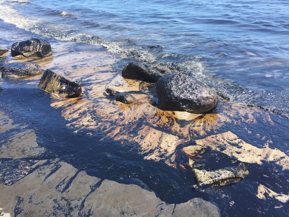
Igor Mezic was at a conference in Snowbird, Utah, when he got word that a ruptured oil pipeline had sent tens of thousands of gallons of crude gushing into the ocean just north of Refugio State Beach.
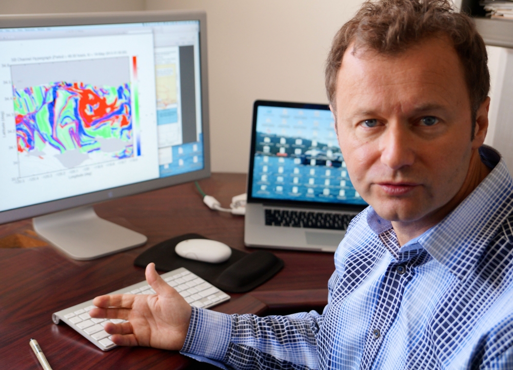
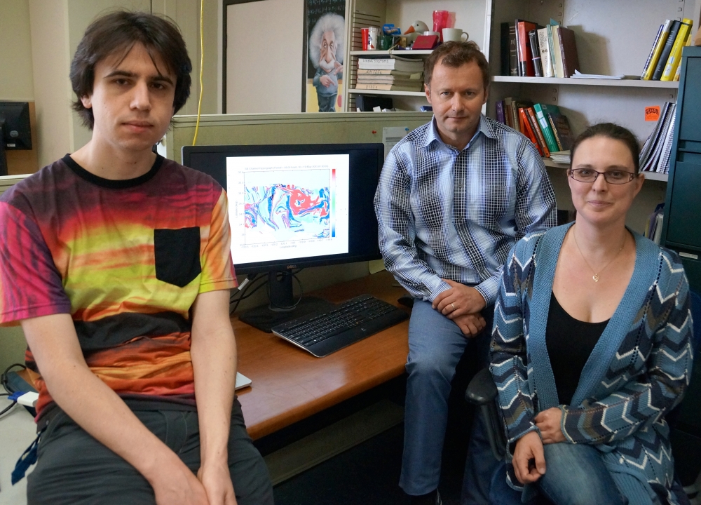
But distance did not deter the UC Santa Barbara professor of mechanical engineering who with former project scientist Sophie Loire, undergraduate Patrick Clary and several of his students was attending the Society for Industrial and Applied Mathematics’ Conference on Applications of Dynamical Systems. They immediately began gathering data and producing hypergraphs that, based on calculations of velocity streams, allowed them to predict in what directions the oil might spread.
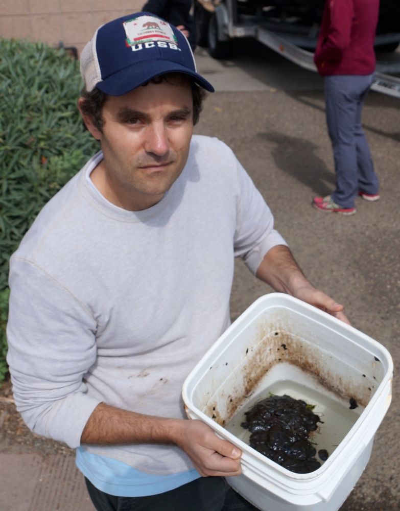
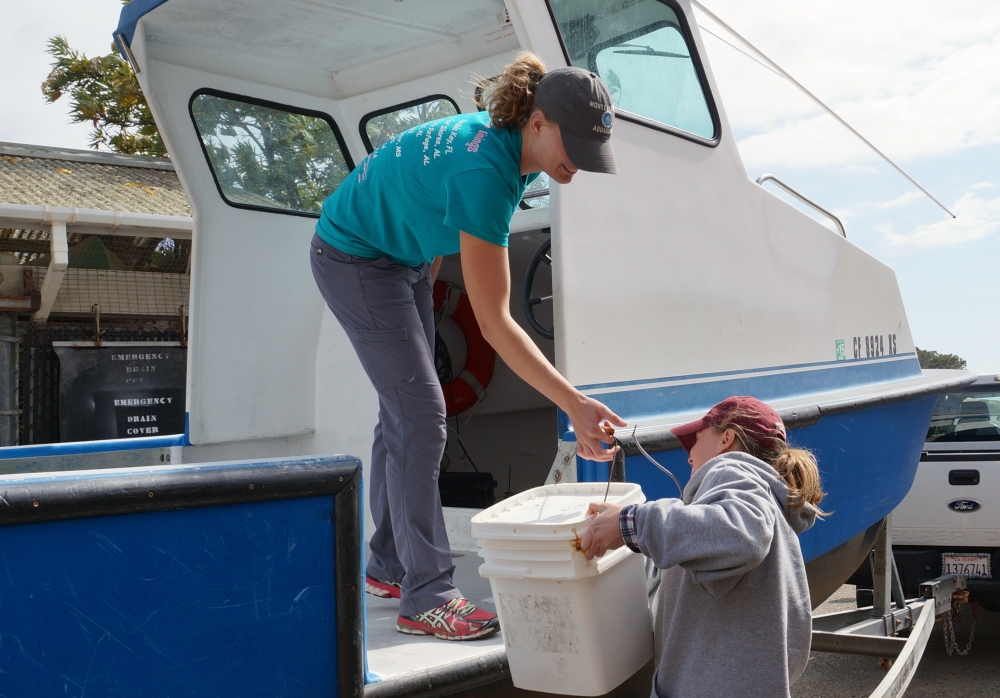
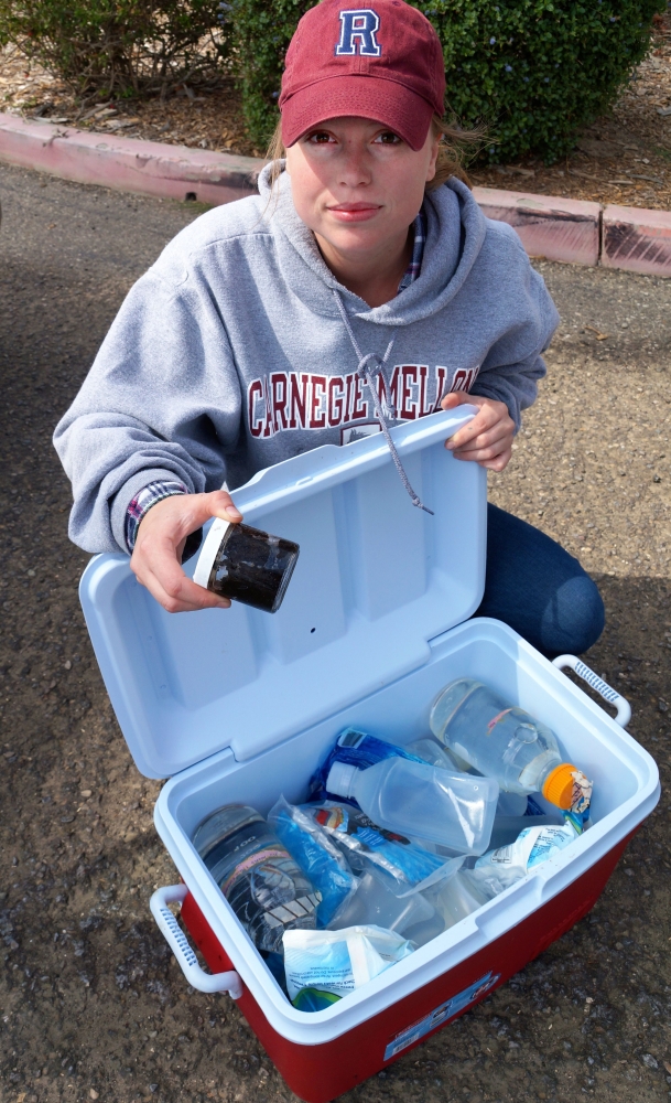
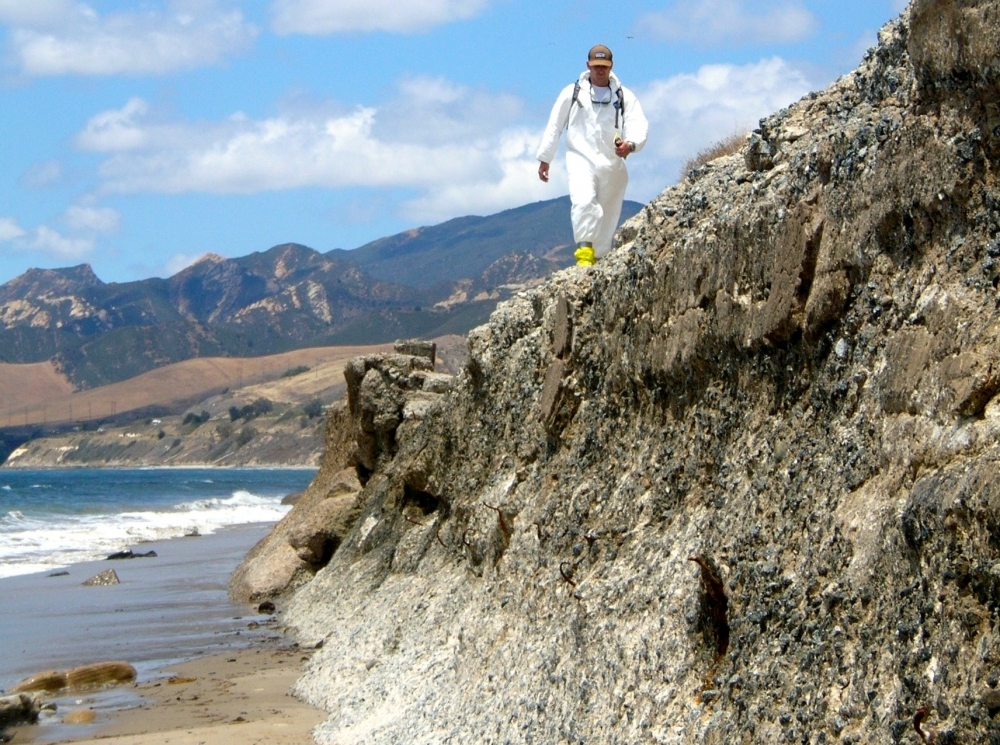
At the same time, when David Valentine, a professor of earth science at UCSB and an expert on the behavior of oil and methane in the ocean, heard the news, he and two of his students quickly made their way up the coast. They began collecting oil samples from areas up and down the beach and in the ocean.
Mezic and Valentine are two in a large group of UCSB scientists, researchers and engineers who have responded to the oil spill by pooling their considerable expertise. Working often in collaboration with one another, they are gathering and providing myriad data and observations to agencies such as the Southern California Coastal Ocean Observing System, which is working with the National Oceanic and Atmospheric Administration’s response team. Their research is likely to help inform ongoing response and cleanup efforts.
“I asked my former project scientist, Sophie Loire, and undergraduate Patrick Clary if we could do something about it, and they sprung into action,” said Mezic.
Valentine and his students have made four trips to the oil spill site to take water samples and track by boat where the slicks have gone. “We’re trying to get the weathering trajectory or, effectively understanding the changes that are occurring to the oil over time,” he said. “That’s useful for the response effort so they know what the oil looks like and where it is.”
UCSB geographer and marine scientist Libe Washburn is part of a research effort monitoring real-time surface currents and plume trajectory via high-frequency radar. “We have a network of equipment along the coast, and Wednesday we installed some of our equipment out near Gaviota,” he said. “This is a new site that we added to improve our coverage and our ability to track the oil movement.”
Also seeking to shed light on how and where the oil might move are David Siegel, professor of geography and director of the UCSB’s Earth Research Institute, and project scientist Leonal Romero. Their research has examined land-ocean interactions in the Santa Barbara Channel to determine how material from coastal streams makes its way into the ocean. “Our focus has been to figure out how coastal streams mix their materials into the ocean,” Siegel said. “We’re taking the same approaches and applying them to a point release just off Refugio Beach.”
It was shortly after the spill that Marko Peljhan, director of the Systemics lab in UCSB’s Media Arts and Technology Program, also got into the response action. He contacted his colleagues in the remote sensing community, with the idea of activating the International Charter on Space and Major Disasters, which provides for acquisition and transmission of space satellite data to relief organizations in the event of major disasters.
Dar Roberts, a professor of geography at UCSB, suggested the researchers make use of NASA’s Airborne Visible/Infrared Imaging Spectrometer New Generation (AVIRIS-NG) instrument for remote sensing.
Two days later, with weather and see conditions aligned, all systems were go and an AVIRIS-NG team that included Peljhan and Ira Leifer, a researcher with the Marine Science Institute, began collecting data along the Refugio coast, from Coal Oil Point to Gaviota. The data consisted of scene endmember and surface sand spectral signatures. The team also conducted a transect beach tar accumulation survey approximately half a mile west of Refugio Beach.
In addition, other UCSB researchers are actively engaged in assessing potential impacts on local coastal species. That includes Carol Blanchette, an associate research biologist with the Marine Science Institute (MSI), who leads UCSB’s rocky intertidal ecology program.
Since the spill, Blanchette and her group are surveying several rocky shoreline sites on Refugio during low tides, documenting species and the extent of the oiling. They are also trying to predict where the oil will move next, Blanchette said, aiming to get out ahead of the oiling to resurvey rocky shore sites, as well as areas in between.
Another MSI associate research scientist, Jenny Dugan, and her team are doing similar surveys on a range of sandy beaches that may be affected by the spill.
Among the other UCSB scientists bringing their expertise to the efforts are:
• Robert Miller, an MSI assistant research scientist, has been on scene scouting the extent of the oil and will be looking at the ecological effects in kelp forests and other benthic settings.
• Uta Passow, a research oceanographer at MSI, has been studying the potential for marine snow formation and sinking.
• Craig Carlson, a professor of microbial oceanography in the Department of Ecology, Evolution and Marine Biology, is studying the interaction of microbial communities and carbon processing in contaminated waters.
• Alison Butler, a professor in the Department of Chemistry and Biochemistry, is looking at iron acquisition by bacteria from the contaminated waters and, potentially, at bacterial transcription patterns.
Further, several researchers and graduate students are being trained in Hazardous Waste Operations and Emergency Response (HAZWOPER) standards in order to assist with ongoing cleanup efforts.
Share this article
Related Stories


