Navigating around the university is just as much a part of the campus experience as the grounds and facilities — an experience that was a priority in the development of UC Santa Barbara’s new interactive campus map: map.ucsb.edu.
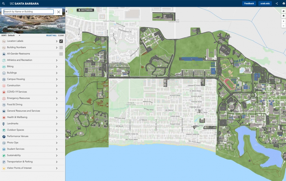
The map covers all of UCSB’s premises in Isla Vista and Goleta in addition to the main campus. It features a menu and search function, with locations cross-listed under multiple categories and keywords. It’s intended to be an accurate, up-to-date resource for everyone to use.
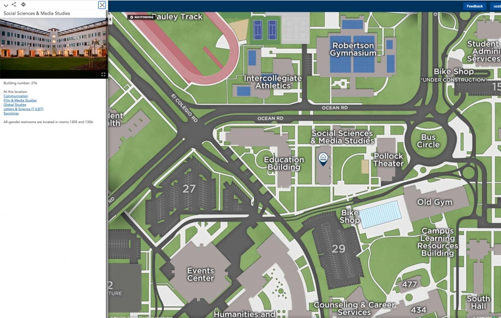
The search function brings up buildings, departments and points of interest. Selecting a location expands a description and, if applicable, a directory of the offices and departments housed there. Campus locations have also been tagged with keywords based on abbreviations, acronyms and affiliations. This provides users with multiple ways to find what they’re looking for.
The map’s navigation menu features a variety of categories including Buildings, Campus Housing, and Food & Dining. These narrow down into subcategories — such as Academic & Administrative buildings, Facilities Management, and Lab Facilities — to help users find what they’re seeking. The categories and layers can be toggled on and off to display different levels of information.
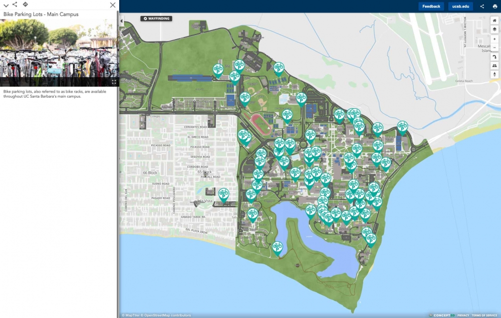
The map isn’t merely a directory of buildings, though. It also includes useful information about other campus features, with categories like Outdoor Spaces and Outdoor WiFi. The Biking category offers specifics about cycling paths and parking, self-service bike stations, pumps and the Associated Students Bike Shop. Meanwhile, visitors can get started with the Visitor Points of Interest category and a Photo Ops section that points out picturesque places on campus. Staff and faculty can explore Meeting & Event Spaces among other General Resources on campus.
Indeed, it’s not just about the locations. The map also conveys where the campus community can access a range of services, including Student Services, Transportation & Parking services, Health & Wellbeing services and many more. There’s even a Move-In subcategory with important instructions about the start of the academic year.
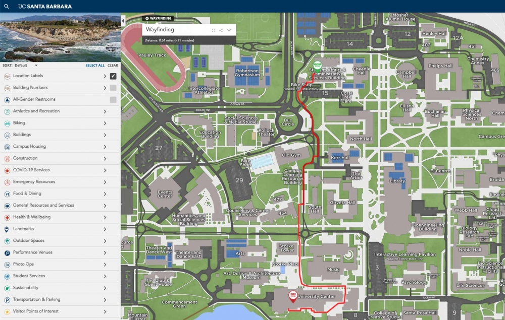
The map provides more accurate and more detailed information about campus locations, enabling visitors to get directions to specific sites on campus from offsite — a feature not supported by familiar map services. It also has a wayfinding feature so that users can plot a route from their location to any other site on campus via the university’s walking paths. It’s optimized for mobile devices and GPS-enabled, so you can use it in real-time on the go.
The interactive map will evolve alongside campus itself, with changes to transportation, new buildings and ongoing Construction all reflected in a timely manner. The administration will continue to enhance it based on user feedback. Any suggestions can be sent to admin@map.ucsb.edu.


