A Dramatic Shift
NASA is ground-truthing data generated by its next-generation earth imaging technology with a major research campaign hosted at three of UC Santa Barbara's natural reserves. The SHIFT (Surface Biology and Geology High Frequency Time Series) project marries high-definition remote sensing efforts with actual samples of land plants, plankton and kelp collected by scientists on the ground. Supporting an upcoming satellite mission that will visualize the surface of the planet in unprecedented detail, the project will dramatically improve our understanding of biodiversity across vast areas of land and sea, analyze the health of vegetation, and track the effects of climate change.
“This is a chance to monitor global biodiversity in a more meaningful way than we’ve been able to before,” said Frank Davis, a professor at the Bren School of Environmental Science & Management, and a principal investigator on the project.
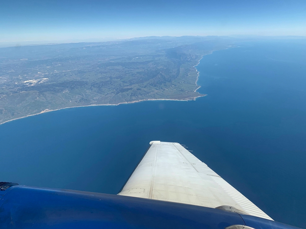
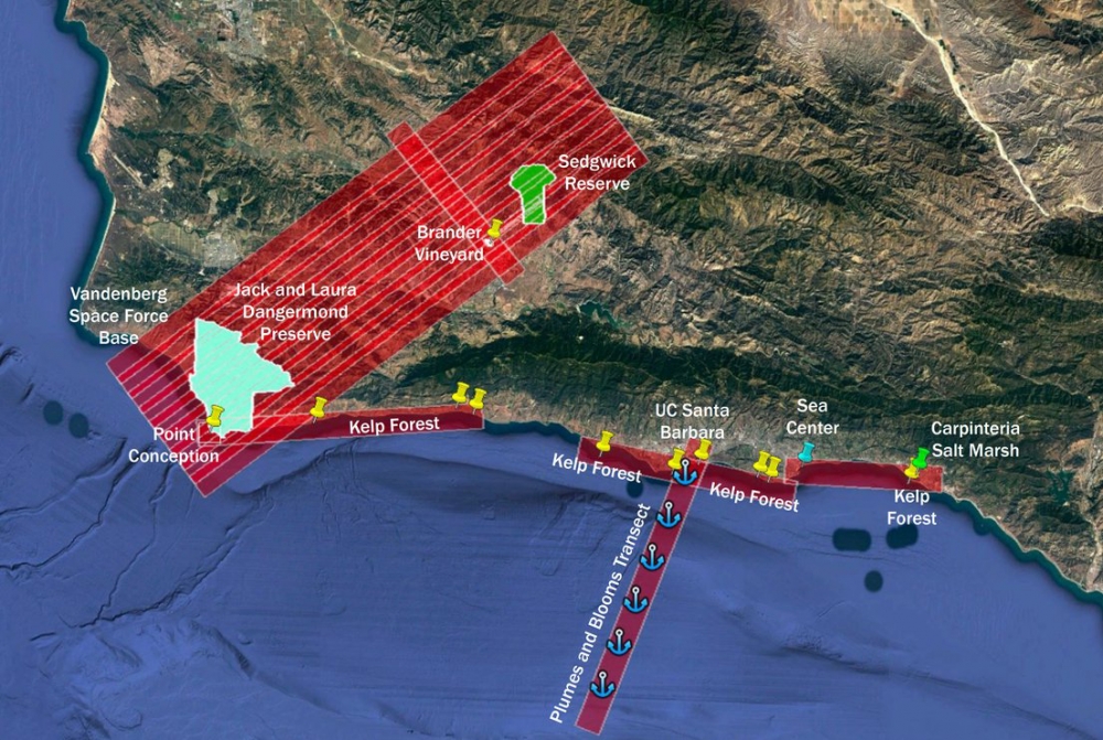
Since March 14, SHIFT has been conducting weekly imaging flights over a 640-square-mile swath of central California together with ground and coastal water sampling. The project will continue through May to capture the spring green-up and summer dry-down of California’s Mediterranean climate. The flights cover an area stretching from the UCSB Natural Reserve System’s Sedgwick Reserve in the Santa Ynez Valley west to The Nature Conservancy’s Jack and Laura Dangermond Preserve at Point Conception. Additional coastal sites include the UCSB NRS’s Coal Oil Point Reserve and Carpinteria Salt Marsh Reserve, plus adjacent kelp forests.
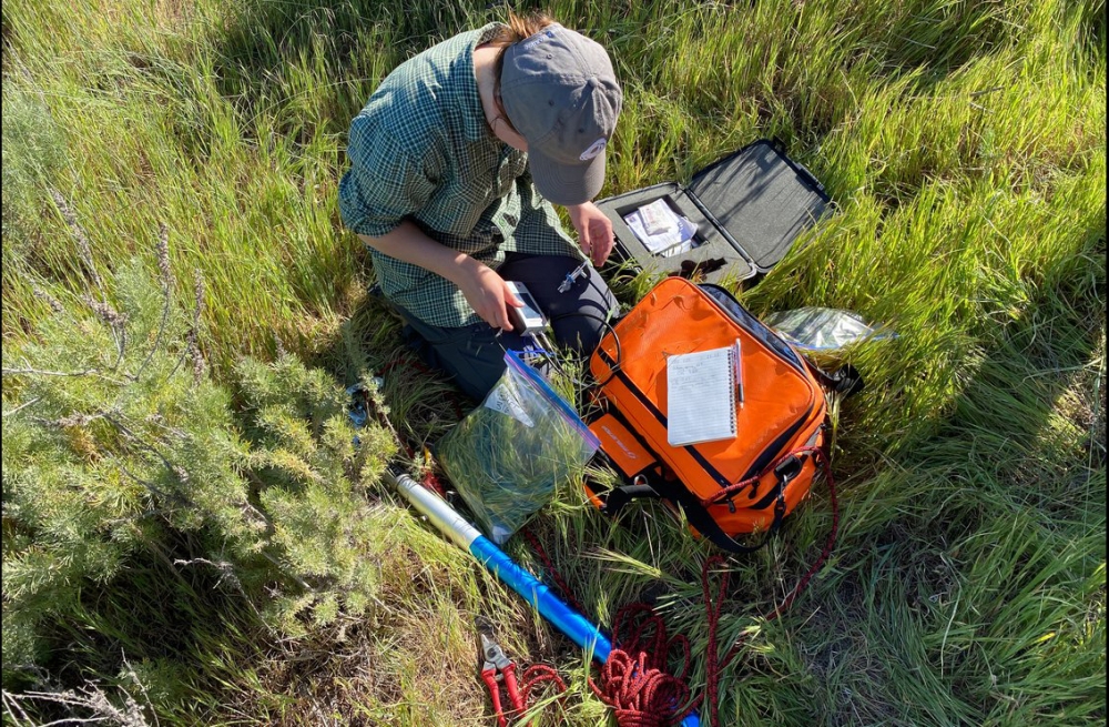
One to two days after each flyover, teams of scientists descend on each site to analyze its vegetation and collect plants for analysis. The researchers lay out sample plots, identify all the plant species they find within its borders, and snip leaf, flower and branch samples. They also take measurements of drought stress and sap flow within trees, and set up cameras to record phenological changes such as wildflower blooms. Additional study methods deploy camera traps and audio detectors to measure animal diversity. At coastal sites, researchers conduct plankton tows and gather examples of both kelp and tidal marsh plants. All of the information will be correlated with the images gathered by the research flights.
Sedgwick Reserve and its La Kretz Research Center, which Davis directs, serve as the headquarters for teams sampling both Sedgwick and the Dangermond Preserve. Sedgwick has ample housing for researchers, while the research center has the lab equipment necessary to sort, measure,and dry the samples. Further tests at the University of Wisconsin will generate information such as the nutrient and fiber content of each sample.
Sedgwick is an ideal spot to support a study linking remote sensing data with biodiversity, according to Davis. “Sedgwick is a big, diverse piece of land that allows you to sample lots of variation and plant diversity within a small area,” he said. “It has a wide variety of geology and soils that support a lot of plant diversity. This lets us test a lot of the algorithms used to retrieve biodiversity information from space.”
Those algorithms should, for example, be able to determine the percentage of evergreen versus deciduous plants, or the amount of woody lignin in the shrubs. This sheds light on how an ecosystem functions, as well as the types of benefits it can provide to people and other organisms.
The SHIFT plane carries an imaging spectrometer that senses light from visible to the near-infrared portions of the spectrum. The AVIRIS-NG (Airborne Visible/Infrared Imaging Spectrometer-Next Generation) instrument gathers 425 different color channels across that light range. By comparison, the imaging spectrometers on NASA’s Landsat and MODIS satellites gather a mere eight to ten channels.
The fine-grained detail in the AVIRIS-NG images provides information missed by the older technology. “Because the information is at such high resolution, you’re getting data vegetation composition and change that are of great value to not just the science community but also resource managers as well,” Davis said. For example, the images can show how much nitrogen is in the grass and leaves, a measurement of how nutritious it is for browsing deer and cattle alike. It can also reveal whether the tree canopy in one area is drier and more fire-prone than in another, knowledge valuable to wildland firefighters as well as climate modelers.
In addition to providing new perspectives on remote sensing biodiversity, the SHIFT project will help NASA work out operational details of a satellite mission scheduled to launch in 2026. With the same type of spectrometer used in SHIFT, the one to two planned satellites will document vegetation changes across terrestrial and coastal surfaces of the entire globe several times a month. SHIFT will help fine tune mission parameters such as the frequency of flyovers. For example, SHIFT will show how much seasonal change is missed if flights occur every two to four weeks versus every week.
SHIFT is an airborne and field research effort jointly led by The Nature Conservancy, UC Santa Barbara, and NASA/JPL.
Share this article
Related Stories


