Lessons from a Cooling Climate
Usually, talk of carbon sequestration focuses on plants: forests storing carbon in the trunks of massive trees, algae blooming and sinking to the seabed, or perhaps peatlands locking carbon away for tens of thousands of years.
While it’s true that plants take up large amounts of carbon from the atmosphere, the rocks themselves mediate a great deal of the carbon cycle over geological timescales. Processes like volcano eruptions, mountain building and erosion are responsible for moving carbon through Earth’s atmosphere, surface and mantle.
In March 2019, a team led by UC Santa Barbara’s Francis Macdonald published a study proposing that tectonic activity in the tropics, and subsequent chemical weathering by the abundant rainfall, could account for the majority of carbon capture over million-year timeframes.
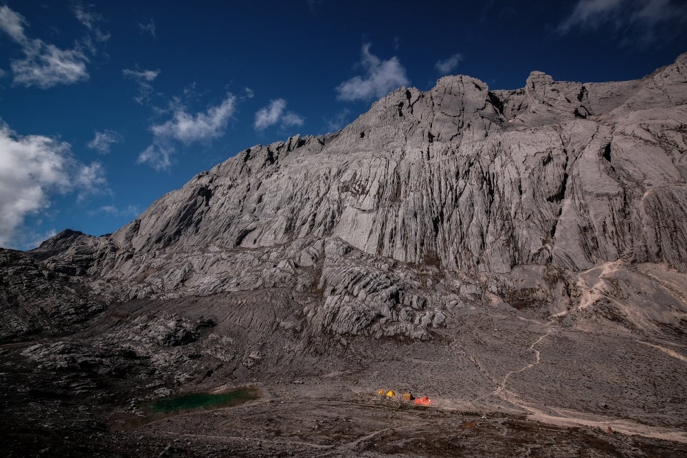
Now, Macdonald, doctoral student Eliel Anttila and their collaborators have applied their new model to the emergence of the Southeast Asian archipelago — comprising New Guinea, Indonesia, Malaysia, the Philippines and other nearby islands — over the past 15 million years. Using data from the paleo-record, they determined that the islands are a modern hotspot of carbon dioxide consumption. Their results, published in the Proceedings of the National Academy of Sciences, deepen our understanding of past climatic transitions and shed light on our current climate crisis.
The primary means by which carbon is recycled into the planet’s interior is through the breakdown of silicate rocks, especially rocks high in calcium and magnesium. Raindrops absorb carbon dioxide from the atmosphere and bring it to the surface. As the droplets patter against the stone, the dissolved carbon dioxide reacts with the rocks, releasing the calcium and magnesium into rivers and the ocean. These ions then react with dissolved carbon in the ocean and form carbonate compounds like calcite, which consolidates on the sea floor, trapping the atmospheric carbon for tens of millions of years or longer.
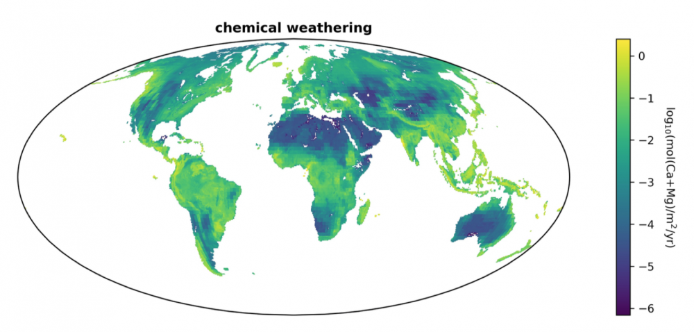
The bright colors of the Southeast Asian archipelago in this map indicate that the rock there undergoes a lot of chemical weathering, which breaks it into constituents that can then consume carbon dioxide.
Photo Credit: FRANCIS MACDONALD
Given the right conditions, and enough time, the deep carbon cycle can lock away enough carbon to plunge Earth into an ice age. “Last year we found that there was a nice correlation between when we make a bunch of mountains in the tropical rain belt and when we have cooling events,” said Macdonald, a professor in the Department of Earth Science.
Carbon dioxide levels in the atmosphere spiked in the mid-Miocene climatic maximum, around 15 million years ago. Although there is still some uncertainty, scientists believe that atmospheric CO2 levels were between 500 and 750 parts per million (ppm), compared to pre-industrial levels of around 280 ppm. During the mid-Miocene, warmer conditions stretched across the globe, the Antarctic ice was meager, and the Arctic was completely ice free.
Today we are around 411 ppm, and climbing, Macdonald pointed out.
Around that time, the Eurasian and Australian plates began colliding and creating the Southeast Asian archipelago and few of the present islands were emergent above sea-level. “This is the most recent example of an arc-continent collision in the tropics,” Macdonald noted, “and throughout this period we actually have proxy data for the change in CO2 levels and temperatures.”
The team was curious how large an effect the emergence of the islands may have had on the climate. Based on their previous hypothesis, the formation of these largely volcanic rock provinces in the tropics should be a major factor in determining CO2 levels in the atmosphere.
They applied geological data of ancient shorelines and lithology to a joint weathering and climate model, which accounted for four major variables: latitude, topography, total area and rock type. In the tropics, a more mountainous region will experience more rain, and have a greater surface area for weathering to occur. Once the surface rocks are weathered, the combination of erosion and uplift exposes fresh rock.
“What you need to do is just keep removing that soil, keep getting fresh rock there, and keep dissolving it,” explained Macdonald. “So having active tectonic topography is key. All of Southeast Asia has active topography, and this is a big reason why it’s just so much more effective at breaking rocks down into their constituent ions so they can join into the geochemical cycles.”
The team’s analysis bore this out. They found that weathering, uplift, and erosion just in the Southeast Asian islands could have accounted for most of the drop in CO2 levels between the mid-Miocene climate maximum and the Pleistocene ice ages, when carbon dioxide was around 200 ppm.
These findings could provide insights on our current climate crisis. “The reason scientists are so interested in understanding the Miocene is because we think of this as perhaps the best natural analogue to what the world may look like at a CO2 level over 500 ppm,” said Macdonald. “It was the most recent time where we had significantly less ice on Earth, and we had CO2 levels that are in the range of where we’re going in our current anthropogenic experiment.”
“People should be worried not necessarily about the amplitude of the increase, but the slope,” added Anttila. “That’s that real problem right now.” Humans have moved a comparable amount of carbon into the atmosphere in just a few generations as it took the Earth to pull out of the atmosphere over millions of years.
“You realize that we are more effective than any geological processes at geoengineering,” Macdonald said.
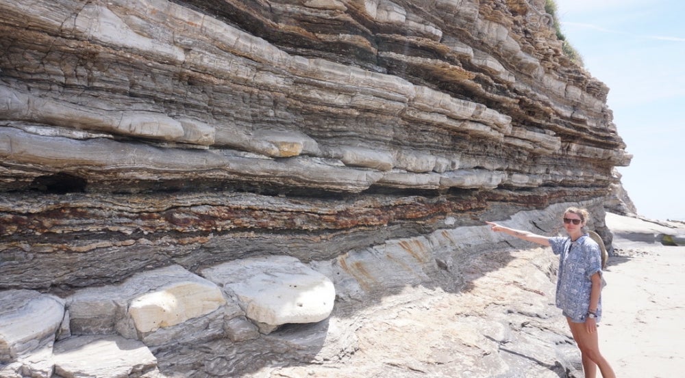
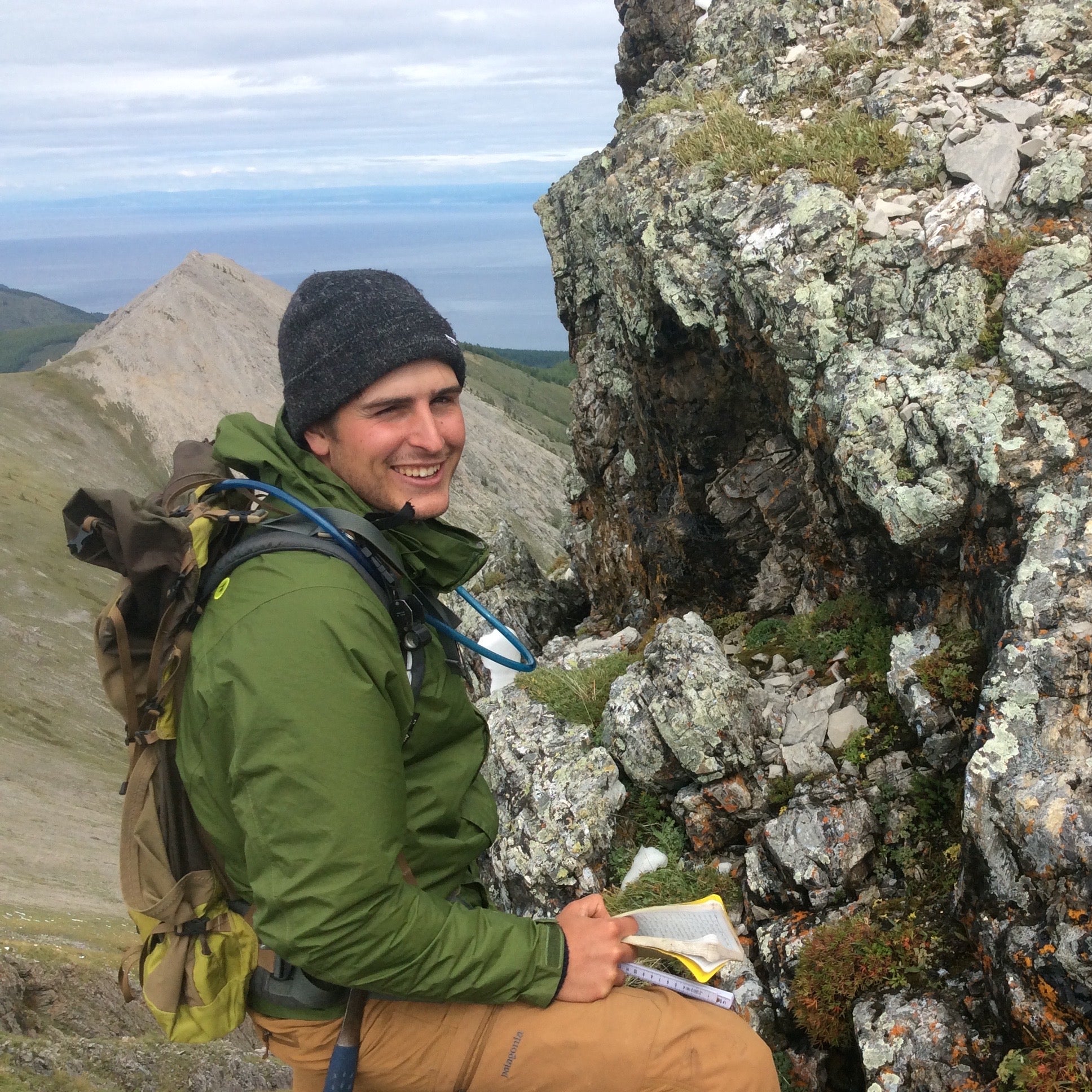
One of Macdonald’s field assistants points out one of the more picturesque sections of the Monterey Formation exposed at Tajiguas Beach, just west of Refugio.
Photo Credit: ELIEL ANTTILA
The team is currently developing a model and looking at the rocks themselves to reevaluate previous hypotheses for the initial cooling. By a stroke of good fortune, the original specimens used to develop these hypotheses are from the Monterey Formation, a layer of rock that crops up throughout the Santa Barbara basin. These rocks dominate cliff faces from Santa Barbara to Goleta Pier and from Coal Oil Point to Gaviota.
“We’ve got this amazing opportunity right here to reconstruct this time period, right in our backyard,” said Macdonald.
“These records of going from a warmer climate in the Miocene to the cooler climate of today are recorded right here in the cliffs,” he added. “So further tests of the hypotheses — especially in quarantine times, when we can’t travel — may just involve going out to the beach.”
Share this article
Related Stories


