Jumping Course

From the Nile to the Mississippi and from the Amazon to the Yangzi, human civilization is inextricably linked to the great rivers along which our societies developed. But rivers are mutable, and the benefits they bestow can quickly become disasters when these waterways change course.
Scientists are working to understand how environmental changes alter river dynamics. A new study in the Proceedings of the National Academy of Sciences coauthored by UC Santa Barbara geomorphologist Vamsi Ganti has outlined the factors that dictate how often rivers jump course, or avulse, and the effects this will have on river deltas. The results promise to help scientists and planners prepare for a future of sea-level rise and changing land use.
Deltas counteract sea level rise by building up sediment, which mostly occurs near a river channel itself. Every once in a while, the river will switch course through an avulsion and begin building up the delta somewhere else. “So avulsions are the way that the river spreads its sediment out over the whole landscape,” said first author Austin Chadwick, a postdoctoral scholar at University of Minnesota.
“The questions we’re asking are how often do rivers naturally change their course,” he continued, “and how is that going to change with climate change and human interference.”
Unfortunately, there has previously been no consensus on how rivers responded to climactic shift. Some scientists thought avulsion rates would increase as sea level rises, while others predicted they’d decrease. “There simply was no unifying theory to explain how river avulsion frequency is dependent on sea level,” Ganti said.
To straighten out the situation, Ganti, Chadwick and their coauthor Michael Lamb of Caltech, combined observations from the geologic and historical records with a mathematical model of river dynamics. By focusing on this specific issue, they aimed to finally get definitive answers and useful predictions.
Large rivers tend to flatten out and decelerate as they approach the ocean. After a certain point, the downstream conditions of the sea level begin to influence the river’s behavior in what scientists call backwater hydrodynamics. “This is a dynamic zone where deposition and erosion occurs in coastal rivers,” Ganti explained.
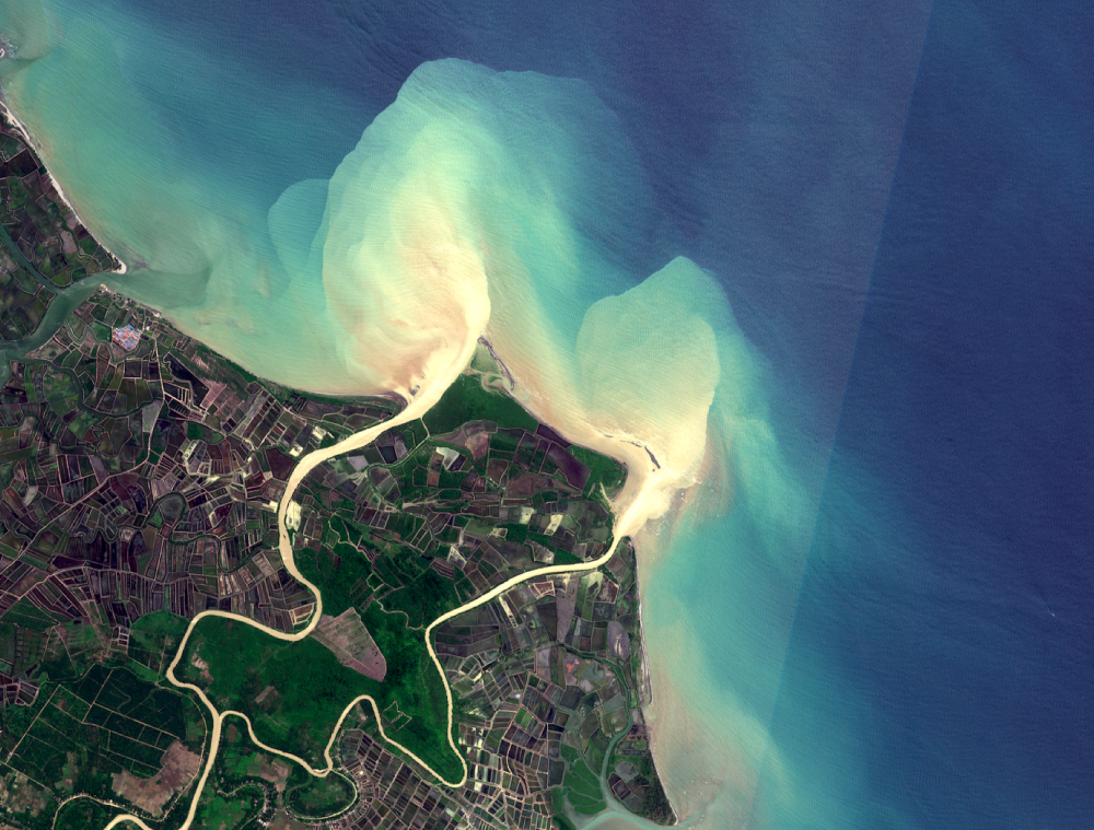
A satellite image of the Mississippi River delta. The avulsion location is about 20 miles south of Baton Rouge.
Photo Credit: AUSTIN CHADWICK
In a previous paper, the team had shown that avulsions occur within this backwater region, which can extend quite far inland. For instance, the backwater zone of the Mississippi River reaches 500 kilometers from the coast. Deeper, flatter rivers like the Mississippi, which have larger backwater regions, therefore have larger deltas.
The researchers goal with this study was to apply their newfound understanding of the impact of backwater hydrodynamics to learn about the frequency of avulsions themselves.
Using the model, and comparing their results to field data, the team discovered that there are three ways that deltas can respond to sea level rise, which depend on the balance between the rate of sea-level change and the sediment supplied by the river.
The first: when a river has a lot of sediment and sea-level rise is relatively slow. According to the model, these rivers are resilient to sea-level rise, and their avulsion rates remain stable. China’s Yellow River is one example.
The second case occurs when a river has less sediment or the sea level rises more quickly. In this scenario, avulsions become more frequent. The rising ocean promotes sedimentation, and once a channel fills to a certain depth, the river will jump its course.
And representing the extreme, in which sea level rise outpaces a river’s ability to deposit sediment, is the third case. As the ocean infiltrates the delta, the river will reach its maximum avulsion rate, and the whole system will begin migrating inland. Scientists hadn’t known about this case before, and the discovery of the three regimes together explains the previous inconsistencies in the scientific literature.
The researchers inputted observations and data into their model to see whether various river deltas would behave differently under predicted climate conditions. “The answer is yes, for most of them,” Chadwick said. “Many rivers will experience more frequent avulsions and some rivers will also have avulsions farther inland.”
River avulsions have huge societal implications, with the potential to cause economic and civil unrest. Archaeologists believe that a course change of the Indus River in western India directly contributed to the decline of the Bronze Age Harappan civilization. More recently, avulsions led to the 1877 Yellow River flood and 1931 China floods, two of the deadliest natural disasters in modern history.
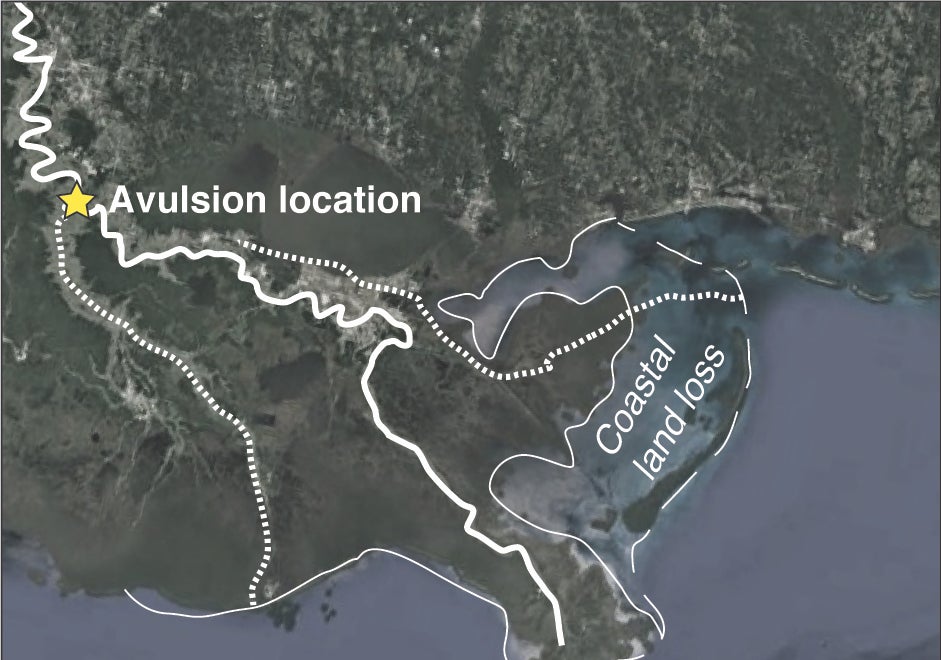
An avulsion could have dire consequences for rivers like the Mississippi, where a system called the Old River Control Structure has prevented the river from jumping course since 1963. If the backwater region migrated inland, the river could change course upstream from the facility and bypass it altogether. Millions of gallons of water per minute would course through previously dry land, while the downstream portion of the channel would go completely dry.
The authors have made their model available and accessible to anyone who might want to use it. They were even able to reduce several formulas into a single equation by implementing a few basic assumptions about river conditions and dynamics.
“Groups like the Army Corps of Engineers and the Department of the Interior can use this tool to apply to any delta,” said Chadwick. “And hopefully it will help inform our decisions in these places as we cope with climate change.”
Share this article
Related Stories


