When the Earth Moves
When Jamison Steidl heard about the devastating earthquakes that struck Nepal, his first thoughts were for the people.
“The first reaction is, ‘What a tragedy’ and, ‘How horrible for people there,’” said Steidl, a research seismologist at UC Santa Barbara’s Earth Research Institute. “The second is, ‘Are we going to get data? Are we going to learn anything?’”
Because of limited strong-motion monitoring in Nepal, scientists learned less than they would have hoped from the destructive series of quakes. However, with a grant from the U.S. Nuclear Regulatory Commission (NRC), Steidl and his UCSB team are poised to add to the global knowledge of how earthquakes affect ground movement and soil stability, continuing research that has been underway at the university for more than 25 years.
The grant totals approximately $533,000 over two years.
By monitoring and analyzing data from six West Coast sites, Steidl and project engineer Paul Hegarty, with the help of graduate and undergraduate students, will work to improve scientists’ ability to predict how the ground will shake when a temblor hits. Structural engineers can then translate these ground-motion prediction improvements into safer designs for homes, buildings and critical facilities such as hospitals, dams and power plants around the world.
The NRC will use the information gathered by UCSB researchers to consider potential updates to its regulatory guidelines for nuclear facilities, a matter of significant concern after a 2011 earthquake and tsunami in Japan damaged the Fukushima Daiichi nuclear power plant, causing the worst nuclear disaster since Chernobyl in 1986.
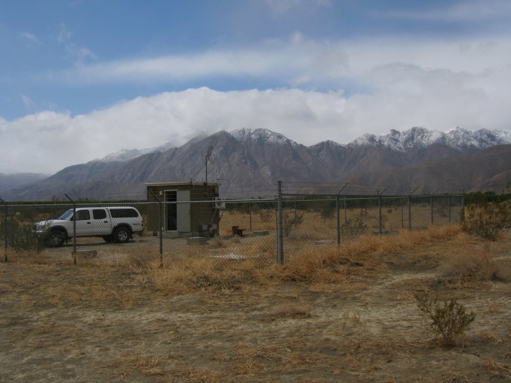
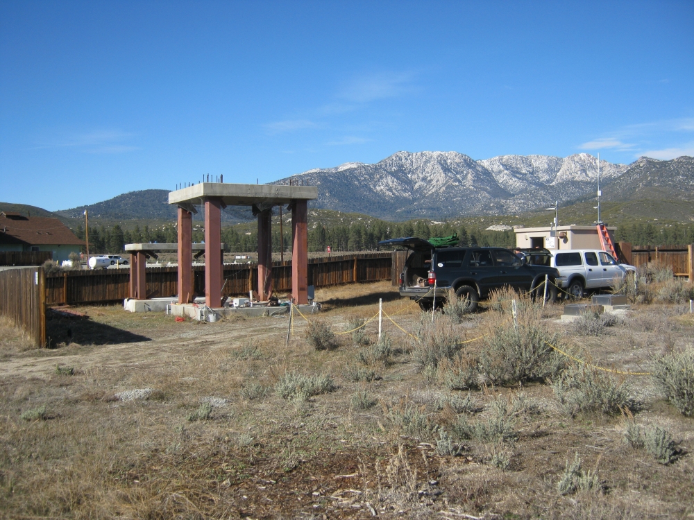
UCSB monitors six information-gathering sites from Southern California to Alaska, maintaining its own facilities near the California cities of Palm Springs, Brawley, Borrego Springs and Salinas. The researchers also utilize data from sites operated by the U.S. Geological Survey’s Advanced National Seismic System in Seattle and in Anchorage, Alaska.
All the locations are equipped with accelerometers that measure ground-shaking intensity. Sites in areas vulnerable to liquefaction (which occurs when soil is turned fluidlike as a result of a strong earthquake) are equipped with instruments called pore pressure transducers.
“If the pore water pressure at depth in the soil becomes larger than the weight of the soil above it, then you’re basically floating,” Steidl said. “If you have a structure above that, it’s now sitting on a very unstable column of soil.”
Analysis of the data transmitted by the sensors helps scientists predict what is likely to happen in future quakes. Learning how to predict the earthquakes themselves is the Holy Grail, but for now that remains a goal for the future.
“When we talk about earthquake prediction, it has to be the time, the magnitude and the location,” Steidl said. “If you predict there will be an earthquake but it’s a 1, nobody cares. If you predict an 8 but not where it will happen, it’s not useful.
“My own sort of bias is that I probably won’t see an earthquake prediction capability in my lifetime, and the reason is that the human time scale is so different from the earth’s time scale, the geologic time scale,” he continued. “We’re just a little blip. We haven’t been around long enough yet to experience what is called the earthquake cycle. We need more data before we’ll be able to make accurate predictions.”
That data is being gathered quake by quake. But until scientists have the capacity to predict when and where earthquakes will happen and how large they will be, researchers are working to help engineers and governments build stronger buildings around the world to limit the destruction and the loss of life that happens when the ground beneath us shifts.
Share this article
Related Stories