A Close Brush With Disaster
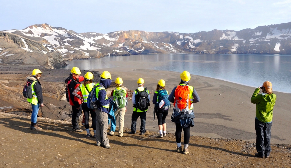
When part of Iceland’s Askja volcano collapsed last month in a massive landslide that created a tsunami in Lake Öskjuvatn, a group of UC Santa Barbara students and faculty members had nearly front-row seats. By a stroke of luck, they were in the area conducting fieldwork as part of a summer course.
“For all of us, whether student or professor, it was a once-in-a-lifetime experience to see the dramatic effects of such a rare event almost in real time,” said course instructor Phillip Gans, an associate professor in the Department of Earth Science. “We had been there hours before and were able to witness the effects immediately after, even to the point of seeing the lake still oscillating a little bit.”
Although some scientists speculated at first that the slide could have been triggered by an eruption, the consensus among them is that it was more likely caused by warmer temperatures and snow melt. These destabilized Askja’s very steep, rocky slopes and created a huge plume of steam. The events provided an unparalleled opportunity for the group that was visiting the country as part of an exchange program with the University of Iceland.
“Many volcanic processes occur at a scale that’s hard to fathom; the vastness and power of some of these geological phenomena are difficult to appreciate,” said André Wyss, chairman of the Department of Earth Science and one of the faculty members visiting Iceland. “Even though in the grand scheme of things, this was just a tiny event, it was nonetheless sobering to see what even a relatively small rockfall like this could do.”
Iceland is known for a high concentration of active volcanoes due to its location on the Mid-Atlantic Ridge, where two tectonic plates diverge. The island country has 30 active volcanic systems, 13 of which have erupted since its settlement in AD 874. Eruptions in Iceland occur on average every few years.
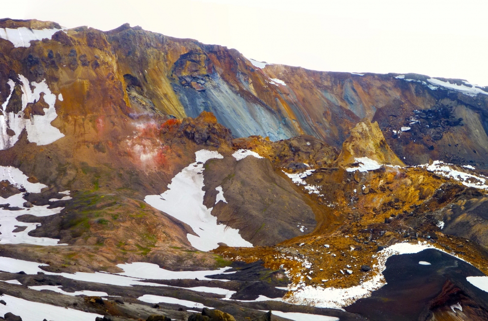
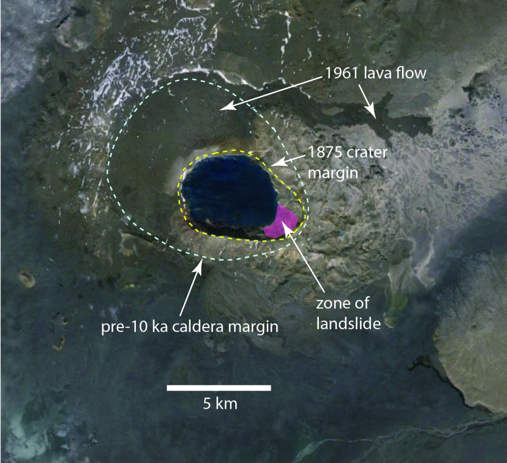
Askja is a complex of nested calderas — cauldronlike volcanic features formed by the collapse of the Earth’s surface following an eruption. The smaller caldera at Askja, occupied by Lake Öskjuvatn and created by an eruption in 1875, is surrounded by an 8-km-wide outer caldera formed more than 10,000 years ago.
Despite its basaltic composition — the most common type of lava flow, which usually produces gentle slopes — Askja is steep because it was formed mainly by subglacial eruptions. Erupting into a vault of icy water, liquid magma produces rocky pillows or fragments in explosive, glassy eruptions beneath the last ice age’s glacial cap, which is up to 2 km thick. The region (where Apollo astronauts regularly trained for their missions) is accessible for only a few months of the year.
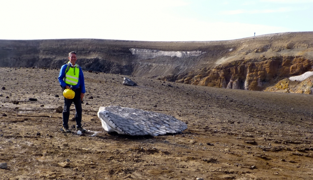
At 11:20 p.m. on July 21, less than three hours after the UC Santa Barbara group had walked the shores of the lake of Askja’s inner caldera, a massive segment of the 300-meter-high southeast crater wall collapsed and slid into the lake triggering a tsunami. When the group rushed back the next day under the guidance of geologist Armann Höskuldsson, a research scientist at the University of Iceland’s Earth Science Institute, a huge part of the ridge above the lake was missing.
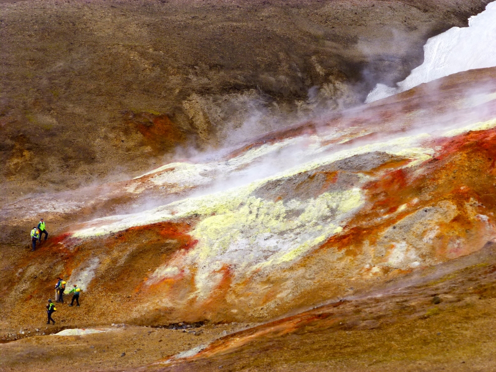
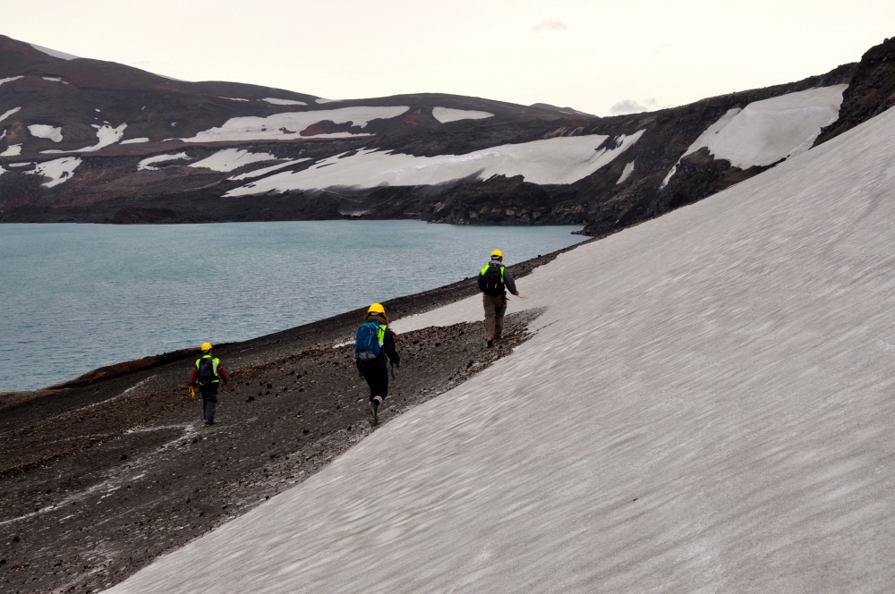
Guided by Höskuldsson and the national park service, the students and faculty gathered data and documented the aftermath. They used GPS devices and cameras to record stranded blocks of snow and ice and the lines of pumice that had washed ashore as each wave of the tsunami surged and receded. Made of rough-textured, porous volcanic glass, pumice is created when superheated, highly pressurized rock is violently ejected from a volcano.
“Amazingly, the highest waves sloshed up the inside of the caldera nearly 200 feet above the lake’s surface,” Wyss said. “Had the rockslide occurred just four hours earlier, our report would have had a decidedly more somber tone.”
Höskuldsson calculates that between 24 and 60 million cubic meters of landslide deposits crashed into the lake, causing the water level to rise 2 to 5 meters (6½ to 16 feet). The group’s surveillance of the highest flood marks indicate that waves crested at 55 to 60 meters (180 to 197 feet).
He is now mapping the lake bottom in order to compare changes resulting from the avalanche with measurements taken in 2012. The findings of the researchers, who in addition to Höskuldsson, Gans and Wyss include earth science professors Douglas Burbank and Matthew Jackson, will be presented in a poster at the December meeting of the American Geophysical Union in San Francisco.
Burbank said the event provided a fantastic learning opportunity. “The students were fully engaged in collecting key data and in helping interpret what we saw,” he noted.
“They heard the debates as we tried to figure out how waves were routed; whether the water receded rapidly or slowly; why some of the inundated slopes and snowfields were covered with mud but others were not; and why the huge rafts of pumice on the lake surface were still moving up and down on the shoreline at intervals of several minutes, even a day after the eruption,” Burbank added. “All in all, we experienced a timely and exciting visit to a very active volcano that had a lot to teach us.”
Share this article
Related Stories